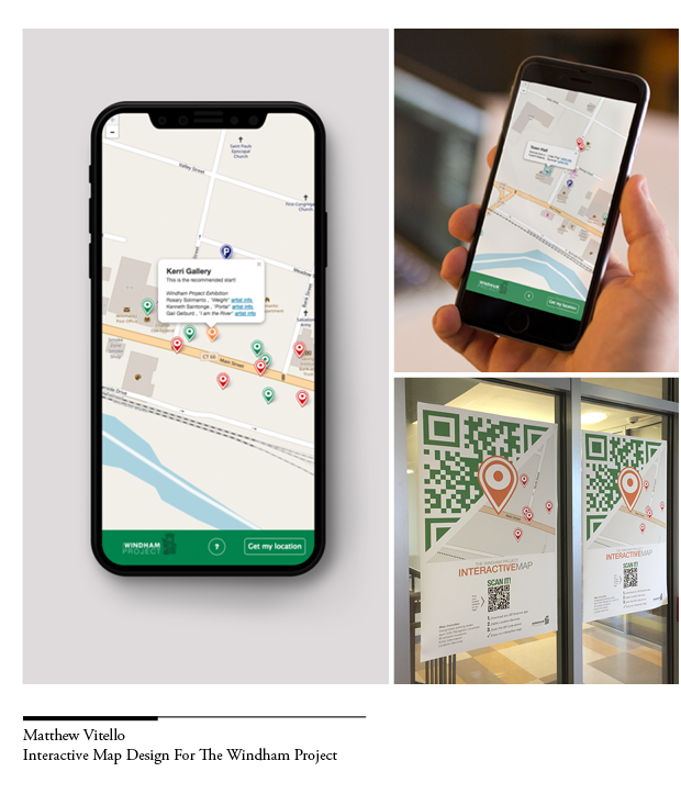
I directed one of my Independent Study students, Matthew Vitello, to develop the interactive map app for the Windham Project. The Windham Project was a collaborative project between Eastern Connecticut State University and the Town of Windham. As the Windham Project featured over twenty artists in the public art exhibition held in downtown Willimantic, CT, Professor Gail Gelburd who founded the project in 2015 discussed with me how to create a more efficient way to guide the viewers to each thriving art scene that artists presented. Aiming this goal, Matthew Vitello, our New Media Studies senior designed a map app that indicates viewer's current location, provides street info, controls the zoom level, and pinpoints the locations of all the artworks and parking nearby. This map app is embedded in the Windham Project official website and can also work alone in various devices. By scanning the QR code, viewers can access this map and find the directions they need on the go. Matthew also designed a poster to promote this creation and the copies of this poster were displayed on campus.
Service learning is blended into my teaching. I strive to find ways to incorporate community-based projects in different levels of my design courses and independent studies.
Projects such as Chaplin Public Library logo design, Pin design for Willimantic 3rd Thursday Street Fest, Windham Senior Center logo design, brochure and poster design for the Windham Region No Freeze Project and etc. were created to provide students the opportunities to connect what they learn in the classroom to real-world challenges.